Havasupai is a Native American Reservation in Arizona. The Havasupai Tribe now live in Havasu Canyon, which contains a campground and some of the best waterfalls on earth. The water stays about 70 degrees year around, and has a strong blue-green color. The turquoise water is caused by the high mineral content in the water.
The land is owned by the Havasu Tribe, and they don't follow the same rules as the NPS. "Visitors to Havasu Canyon assume all risks while in the canyon and should come prepared." This was one hell of an adventure, and I look forward to seeing what trip the crew embarks on next year.
Thursday:
I flew from San Francisco to Orange County, CA. Met up with Nick at the airport, and the crew picked us up. We then drove all night to the trailhead. Not much sleep.
Friday:
We arrived at the trailhead around 6am. Got started hiking around 7am. For the entire hike to the campground, we had our backpacks.
The view from the top.
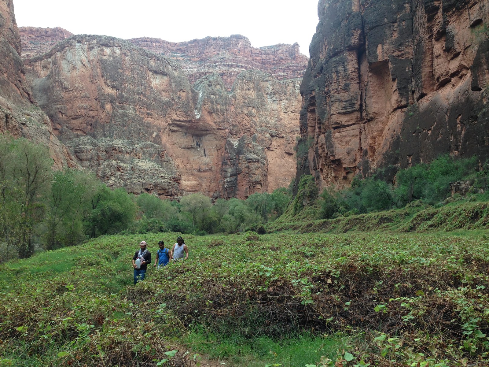
We hiked 8 miles through a lot of canyons, and finally made it to the village, Supai. Supai is very poor and simple. All goods are brought in by helicopter or by pack mules. There are no roads that lead to the village. In fact, the road just to get to the trailhead is 60 miles of desert highway off of Route 66.
We stopped by the tourism office, which is kinda just a shack, and checked in for our reservation. It was then that we learned that the helicopter could shuttle our packs from the village to the trailhead. We left the village in search of a good campsite. The campground is first-come first-served, so we had to search a bit for a good spot.
Our first waterfall sighting. Little Navajo Falls.
But it would not be our last! Havasu Falls.
After hiking another 4 miles from Supai, we finally found a camping spot right as it started to rain. A lot of our stuff got wet. Because of the rain, and after getting only 2 hours sleep the night before, everyone took a nap at around 5pm. The rest of the crew didn't get up from their "nap" until the next morning.
At 8pm, Nick woke me up and we went for a night hike in the rain. We made it to the top of Mooney Falls, but couldn't see anything in the darkness. Later we found out that the falls were just too damn big to be illuminated by a pair of headlamps. We walked back to camp and retired for the night. It kept raining lightly.
Saturday:
Rain and wetness. Not the most pleasant way to wake up.
The campsite.
Aerial view of the campsite. This picture was taken from the cave, I'll get back to that later.
We made some breakfast, and walked back up river to Havasu Falls. We found some jumping spots, and swam around in the water for a few hours. We noticed one or two groups come check out the waterfall, but no one else even went in the water. Private waterfall and swimming hole? We'll take it.
The swimming hole just below the falls.
Pretty close to the falls. Getting sprayed with mist.
We walked back down river to camp, and made some lunch. Then we walked to Mooney Falls. When we got to the top, the sky didn't look friendly. Some people warned us not to go down if it started raining. Someone in our group had to run back to camp to zip up their rain fly. While we were waiting, it started to rain a bit, so we waited in a small dry cave. By the time the group was all together again, the rain had cleared up.
Mooney Falls. For scale, note the green dome tent in the top right corner. It is a big waterfall.
When we got to this point, a group had just finished climbing up "the ladders". One of them was so scared and relieved to have finished, that she puked a few yards from this sign.
This was the only shot I took from "the ladders", because it was one of the few safe places.
Our crew descending "the ladders". The mist from the waterfall coats the chains and ladders. When that mixes with the dry red dust, it forms a slippery mud. So the ladders and chains are covered in mud, and are really slippery. At times there are no ladders, and you just have to hang on to the muddy chains and climb. Really scary stuff.
After we descended the side of the canyon to get to the bottom on Mooney Falls, the weather ended up being fine down there, and we chilled there for a long time. Swimming, snacking, etc..
That's a big waterfall!
We did a small nature hike downriver. Some of the trails are ridiculous. Be prepared to scramble up and down rock faces, caves, cross rivers, etc..
Adi and Ryan in "Buddha Cave"
This drawing was at the back of the cave, and so we named it "Buddha Cave".
Adi walking along the rim of a small waterfall.
The water distributes the mineral deposits at the top of all the waterfalls in such a way that it forms a perfect rim. It's cool because it creates a pool above the waterfall, and it makes the waterfall really ride. It's actually really easy to walk along the rim of the waterfalls that have shallower water.
Eventually we went back to camp, and fixed some dinner. Ryan got out his phone and we watched The Incredibles, and a couple episodes of Family Guy.
After dark, we laid out on the picnic tables and watched the stars for a bit.
Sunday:
After a night of rain, I peeked out of the tent and found lovely blue skies above the canyon walls.
This was the day of our big day hike to Beaver Falls. I think Beaver Falls was about 7 miles from our campsite, so it was ~14 miles round trip.
The vegetation in the canyon is weirdly diverse. It goes from forest, to tropics(we saw a palm tree), to desert, and back.
The crew descending "the ladders" again
There was a lot of little micro habitats in the canyon. This shot shows a vast field covered in vines. Where did the trees go?
Crossing the river.
Don't touch!
Rough hiking.
Beaver Falls. We had the place to ourselves.
Me doing a little jump off of one of the falls that we scouted.
TODO: get GoPro footage from Adi. Some good cliff jumps are on his GoPro.
We had heard stories from other hikers that Beaver Falls can get crowded. But besides our group there was only one couple there. And they actually left after an hour, so we had the place to ourselves. Sweet! Another private swimming hole.
Mooney Falls again on the hike back.
A feast for our last dinner. Each bag is portioned for two people.
We ended up with some extra food, so instead of carrying all of the food back out, we decided to have a feast for our last dinner.
After dinner, Ryan got out his phone again, and we watched Despicable Me 2. It still cracks me up that we had movie nights.
After the movie, Jeff, Adi, and I went to go explore a cave in the canyon wall. It was near our campsite, and we had been curious about it. When we went to explore it earlier during the day, we didn't have headlamps and couldn't see very far inside. We climbed up the wall to the mouth of the cave, which is actually a lot harder during the night. From the entrance, we could only see back about 15 yards so we weren't sure how deep it was actually going to be. We kept walking, and the cave went back deeper and deeper. Due to the bends of the cave, we couldn't tell how far it was going to go. It kept getting more and more tense the further we went. On the way back I counted 82 paces from the back wall of the cave to the mouth. So we think it was probably 160+ feet deep.
When we went to bed, the view of the stars was amazing. We could see the milky way, and there wasn't a cloud in the sky. Or at least the sliver of sky you can see from the bottom of a canyon. After we went to bed, it surprisingly rained really hard that night. Crazy thunder and lightning. One of the guys said a bolt struck within a 100 yards of our camp. I remember the thunder from that one, but I was in my tent at the time, so it just looked like another flash.
Monday:
The view of the cave from our camp.
After the big storm, the river got muddy.
Really muddy.
Muddy water makes a muddy waterfall. Havasu Falls after the big storm.
We hiked from our camp site back to the village with our backpacks. Instead of lugging our packs all the way back to the parking lot, we decided to put the bags on a helicopter for the low cost of $20/bag. Then we used our day packs to make it all the way back to the car. That may sound like a cop-out, but that was still an extremely hard hike. 4 miles with packs + 8 miles with day packs in the desert heat.
This would have been so much harder with full packs.
A line of pack mules carrying a big load down to the village. The only access to the village is by helicopter or the 8 mile mule trail.
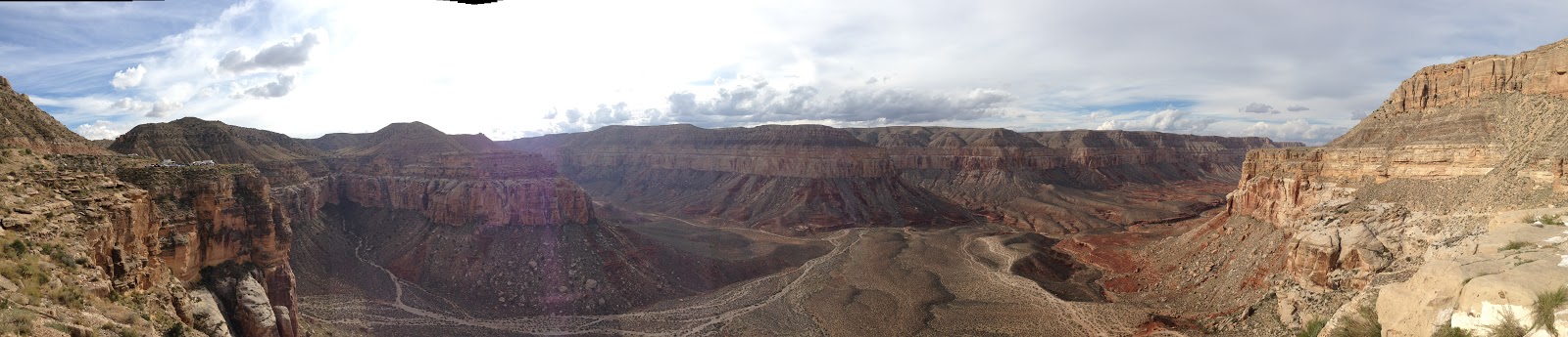
Panorama while taking a break in the shade of the canyon wall.
Panorama from the top of the canyon. We made it out alive!
After we got back to the car around 5pm, there was some celebration before we started the 8 hour drive back to Orange County, CA. Everyone was pretty exhausted, and we didn't get back to Adi's place until 1am.
Tuesday:
I woke up at 5am, and caught a flight back to San Francisco. Home at last. Time to sleep.
This is a late post. The trip happened about a month ago. So it will be shorter on details, since they aren't fresh in my head. Last year's post about Blue Streak
Josh finally made it back to the Bay Area, and organized a trip to Blue Streak to end the summer. The trip almost fell through, because there were some wild fires in the area. But it all worked out.
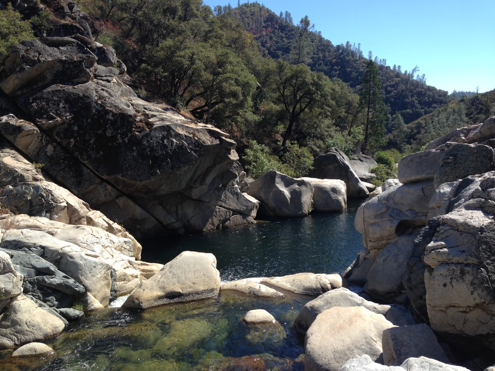
We did an overnight stay at Blue Streak. The water was still freezing cold even in late September. I don't know where the water comes from, but I don't believe it ever really warms up that much.
Great cliff jumping and rock scrambling. And it's always fun to just go camping.
After the first trip to Blue Streak that I did, I didn't remember how to get there or any of the key details. So I kept very detailed notes this time. I saved them in a Google Doc for safe keeping.
Day 1 - Arrival
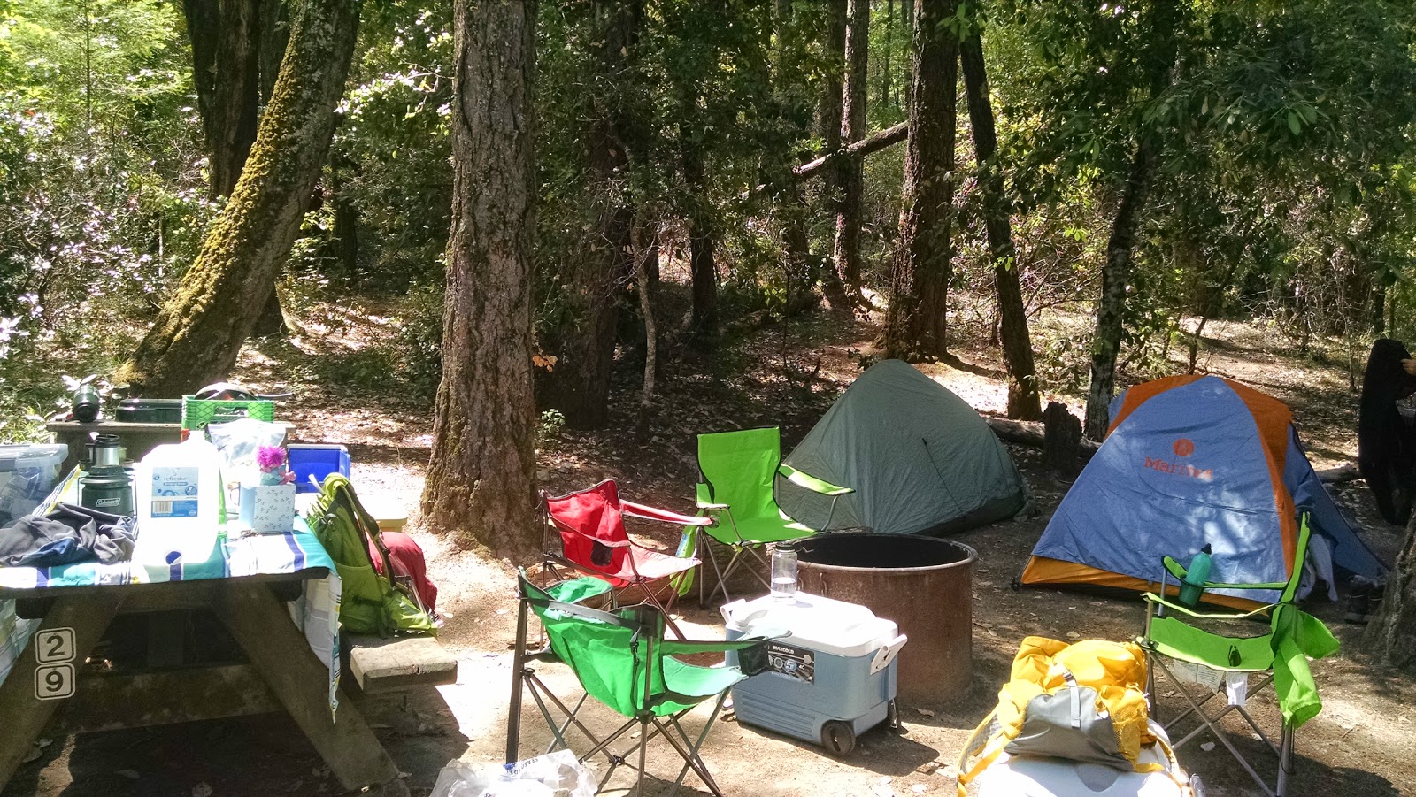
Eileen and I left SF around 3pm, got stuck in some Bay Area traffic, but made it to Bothe-Napa Valley State Park just in time to reserve the last walk-on camp site. The next day we talked the guy in the visitor center, and he said they had to turn around 30 people after us that night.
We setup camp, then went out for dinner to Mustard's Grill. Truly roughing it at a James Beard award winning restaurant. By the time we got back to camp, Abby and Ben had arrived, and they were all setup with a fire.
Day 2 - Hiking and Wine Tasting
Started off the day with breakfast burritos. Very tasty.
The campsite
Eileen reserved an afternoon wine tasting at Frog's Leap, so we went on a day hike near the camp ground. It was a reasonable hike, and we finished just in time to head off for wine tasting.
Wine tasting at Frog's Leap.
The crew.
More wine tasting and sandwiches at Sequoia Grove
Sequoia Grove Winery
Back to camp for chilling and dinner. Made the Parker family classic "Hamburger a la foil".
Day 3 - Departure and Mountain Biking
Blueberry Pancakes. Very tasty.
Packed up camp. Departed
Went to Calistoga. Ben and I biked up Oak Hill Mine Trail for an out an back of about 8 miles total. The ride out was pretty much almost all uphill. The ride up was pretty technical, and I had to walk some of it.
Views from the trail.
View from the top. Cool volcanic rock up there.
Once we turned around and started going downhill, the ride was really fun. After just completing a steep downhill section, and coming up a slight hill, I decided to not down shift and just crank really hard to power up the tiny hill with my existing momentum.
I wasn't paying attention for just a moment, and my front wheel hit a loose rock, and the handlebars swerved right. At this exact moment, I was standing up and cranking super hard with my left foot. So I was off balance at the worst moment, and I went down hard on my left side. It hurt a good bit, and eventually we continued down and got back into town. I took the rest of the down hill a little slower. I washed out my wounds, and Eileen bandaged me up.
There was traffic on the main route back to SF, so Waze took us on a beautiful route through wine country to get home. Not so bad!